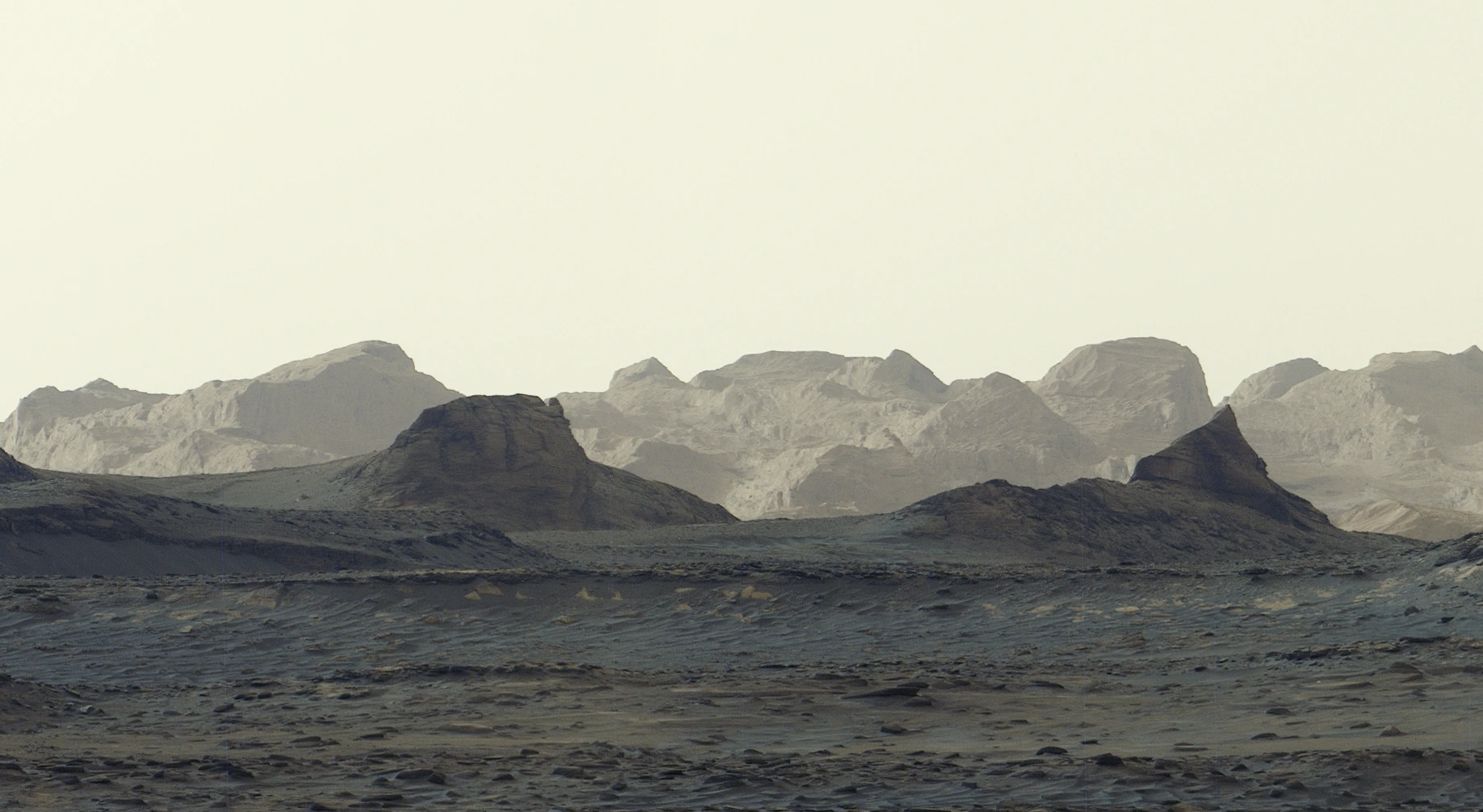
Curiosity has captured wind-carved cliffs on Mount Sharp in the morning light, with a blue-grey foreground beneath bright distant ridges. The six-image panorama brings the yardang layer into sharper view. Scientists hope to reach its base in 2027 to investigate how it formed.
Key points
- Curiosity photographed the scene on 11 August 2026, mission sol 4,982, at 8:30 a.m. local Mars time.
- Six Mastcam images were stitched together on Earth, retaining the morning colours without the usual white-balance adjustment.
- The yardang layer extends about 16 kilometres. Ancient volcanic ash is one possible origin; the team hopes to investigate up close in 2027.
Morning light falls across Mount Sharp on Mars, illuminating distant crags while the foreground retains blue-grey tones. NASA released Curiosity’s new panorama on 6 October 2026, revealing the outlines of this wind-carved landscape and bringing a major upcoming mission target into view.
Six images preserve the morning colours
Curiosity’s Mast Camera, or Mastcam, photographed the scene on 11 August, the mission’s 4,982nd Martian day, or sol. It was 8:30 a.m. local Mars time. The six images were transmitted to Earth and then assembled into a wide panorama.

The processing deliberately omitted the usual white-balance adjustment applied to many Mastcam images, preserving the early-morning appearance. Cooler foreground tones contrast with the sunlit ridges in the distance. Both the lighting at the time and the processing choices influence these colours.
Wind-carved cliffs with an unresolved history
The yardang layer stretches roughly 16 kilometres across the northwestern part of Mount Sharp. Yardangs are ridges sculpted by wind erosion. How their craggy outlines developed and how the underlying material was first deposited are two connected geological questions.
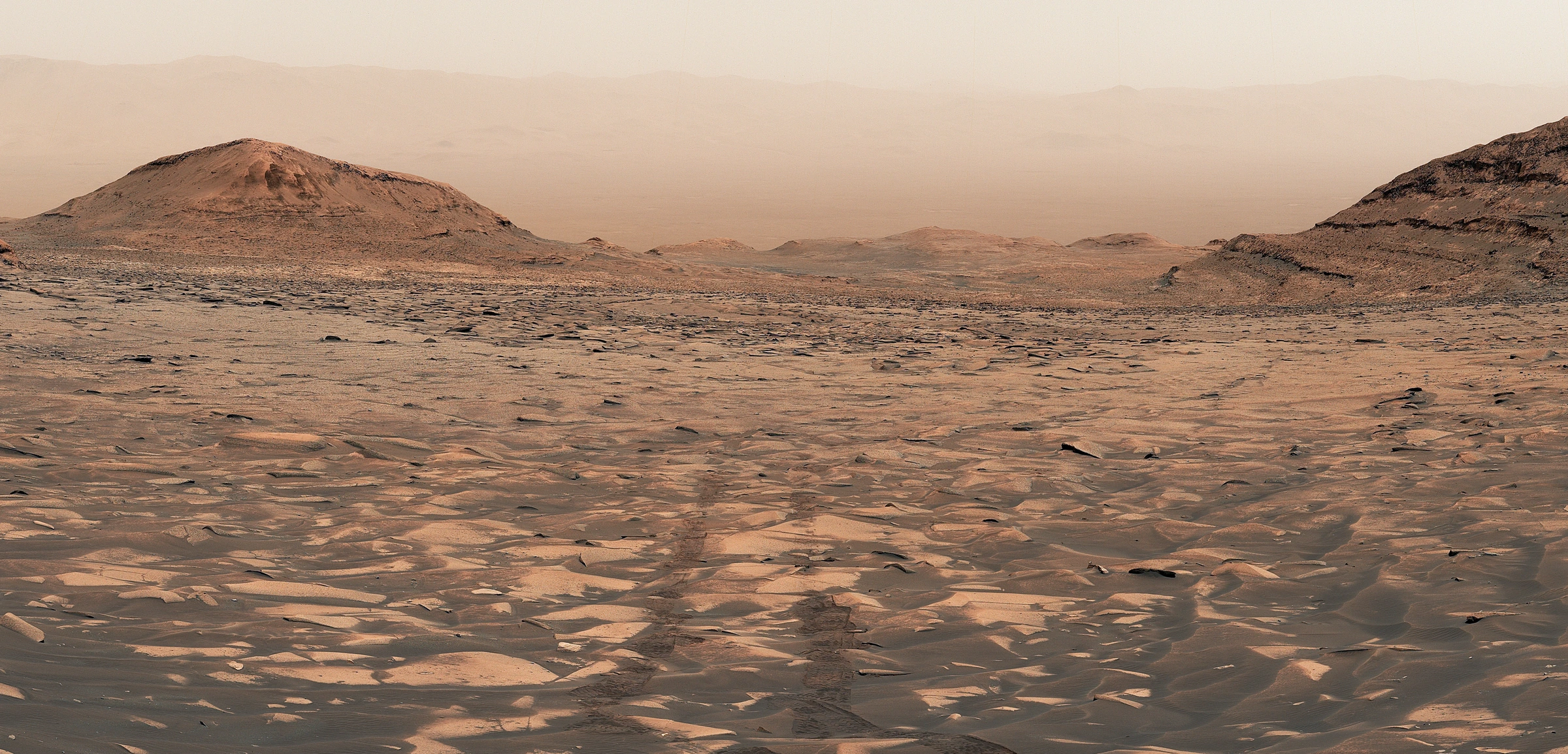
Mount Sharp rises about 5 kilometres, and its rock layers record different periods of Martian environmental history. Curiosity has found evidence of ancient lakes and streams in these layers. As conditions became drier, water receded and left salty minerals behind. Later wind erosion may have stripped away some material, shaping the landscape seen today.
The yardang layer stands out because its colour and the tilt of its layers differ from the surrounding rocks. Mission scientists suggest that ash from ancient volcanic eruptions is one possible source. The official image record also notes that Mount Sharp may have undergone erosion before this layer was deposited, leaving a gap in the rock record. These interpretations await closer investigation.
Next, a closer look at the yardang layer
Curiosity has been climbing Mount Sharp since 2014. On 26 August 2026, it reached an elevation gain of about 1 kilometre above the floor of Gale Crater, marking its progress up the mountain’s slopes.
According to JPL’s mission outlook, Curiosity will spend much of the next year or so crossing layers rich in sulfates and carbonates, following further clues to ancient surface drying. The team hopes to reach the base of the yardangs in 2027 and use the robotic arm to gather close-range data. The morning panorama offers a striking view of Mars and points towards a chapter of its geological history still to be read.